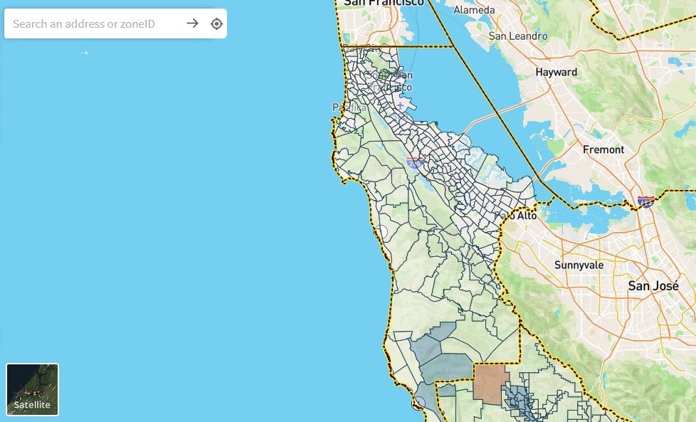
San Mateo County officials have launched an interactive map enabling residents to find out which evacuation zone they live within.
The map, developed, by Zonehaven, was developed in the wake of the CZU Lightning wildfires and is part of the county’s new “Know Your Zone” campaign.
Residents simply enter their address into the map in order to find out their zone. They “should record their zone number and review zone details before the next emergency to be better informed and able to quickly map their best path to safety,” county officials said.
“Community resilience starts with community planning, and I’m proud that the County and our partners are able to provide this critical tool to our residents so that they can be ready if and when they need to evacuate,” said County Manager Mike Callagy. “This is a big undertaking by the County’s Office of Emergency Services and our local law and fire agencies, and they should all be very proud of their enormous effort.”
The “Know Your Zone” campaign will use social media, advertising and other outreach materials to help residents easily remember to visit the site.
Learn more about Zonehaven and the “Know Your Zone” campaign at myzone.zonehaven.com