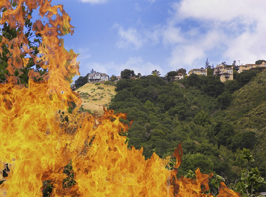
On Sunday, September 27, 1970, just after 11 a.m., an 8-year-old boy wandered into the dry brush behind the homes on Dover Court in San Carlos to sneak a smoke.
A hot, dry wind had come up. The papers and TV news were filled with reports about wildfires that had been destroying Southern California homes for a week.
The threat didn’t register with the boy. He tossed away his cigarette. Minutes later, a corner of the 6-mile-long Devonshire Canyon was aflame.
“I had a feeling all morning this was going to happen,” said Elizabeth Stuart, who lived on a ridge overlooking the canyon.
More than 300 volunteer and professional firefighters rushed to the area, every available crew from San Bruno to Palo Alto.
Five aircraft responded, including at least one huge World War II B-17 bomber that swooped into the canyon and poured a red stream of fire retardant into the blaze, allowing it to burn only west, toward what was then open space.
Fire engines and tankers clogged the 3300 block of Melendy Drive. Residents of seven homes were asked to evacuate. Some left, but others chose to stay and hose down their roofs, mostly made of highly flammable cedar shakes.
Ron Collins, now vice mayor of San Carlos, was a 20-year-old college student who lived on Plymouth Court. “I remember seeing those bombers flying low over the hill and drop fire retardant. It was breathtaking to see the entire canyon burning. It was a different time— there was open land from the top of Devonshire Canyon to the ocean except Canada Road and Skyline.”
The fire burned to within 50 yards of the baseball diamond at the north end of Crestview and 100 yards of the Melendy homes.
Just as it looked grim, the winds unexpectedly died down at 3:30 p.m, and the fire was contained shortly after. There were 35 acres burned and no major injuries.
The Redwood City Tribune called it a “Southern California-style brush fire,” lacking much local precedent. “Had the customary late afternoon winds sprung up Sunday, fire-fighters admit they probably could not have contained the blaze” before it escaped the canyon, the paper said.
Firefighters almost instantly guessed the cause, and by the next day, the mischievous child was identified. No charges were filed, although he did get a stern lecture from his father.
Almost half a century later, smoking rates are much lower, so fewer kids have easy access to cigarettes. In most other respects, though, the risk has increased that the Peninsula could suffer a devastating wildfire.
“There’s a lot more danger now,” said Dave Pucci, deputy fire chief for the Redwood City Fire Department, which also serves San Carlos and some unincorporated areas.
He says fire seasons are worsening for several reasons, including higher temperatures that have lengthened the fire season by 92 days since the 1970s, more periods with offshore winds that dry out vegetation, increased wildland-urban interface development, and more brush that can ignite tree canopies.
Take a half-hour walk around Harold Drake Loop Trail in Big Canyon Park, and the problem will become obvious. Gnarled oaks on the steep hillside grow branches that hang low, touching shrubs, weeds and grasses that that will soon be brown and highly combustible.
Ian and Carol Gray, who live on Melendy Drive overlooking the canyoWn, see worrisome signs. “There’s a lot of fuel down there and I don’t think it would take much for it to ignite,” Ian Gray said. “There’s a lot of poison oak and that doubles the danger, since inhaling the smoke is twice as bad.”
Some help is on the way. Armed with a grant from the Federal Emergency Management Agency that pays 80 percent of the $525,000 price tag, the fire district has a plan to clear brush from Big Canyon, Crestview, Eaton, and Highland parks as well as other city-owned parcels.
The first stage, which was scheduled to begin in mid-May, involves renting a movable crew of goats to munch on grasses for 30 days. The second stage, to begin in midsummer if an environmental review is approved, will send in orange-clad Cal FIRE prison inmate crews to cut back brush and remove tree limbs below the 6-to-8-foot level, creating a shaded fire break, Pucci said.
But not all the land belongs to the government. “How do we get private landowners to take some responsibility maintaining the horrible over-vegetation in the canyon”? Carol Gray asks.
“We have a fire break but the neighbors don’t,” she added. “It’s the steepness and there’s so much fuel. If there was a fire, we’d just go.”
Ian Gray has tried to interest his neighbors in a grassroots movement to reduce risk, including by trimming vegetation deep in the canyon where there are no structures. “I contacted 24 neighbors and only three responded,” he said.
State codes require property owners to have 100 feet of defensible space around structures in a mountainous area, forest and brush-covered lands. However, they do not require removal of vegetation on privately owned parcels without structures.
The codes are not uniformly enforced among the many fire agencies in the state. Bill Dodd, a state senator from fire-hit Napa, is sponsoring S.B. 190, which would include a model brush clearance program mechanisms to enforce defensable space.
Building codes enacted in 2008 require new homes in high-risk areas to have fire-resistant roofs and siding. However, older homes make up the vast majority of the housing stock, and they don’t have to be retrofitted. Even on the most threatened blocks of Melendy, a few houses still have shake roofs.
Only a few communities, such as Big Bear Lake, have enacted strict codes banning shake roofs and requiring retrofitting.
An analysis by the Sacramento Bee of last November’s devastating Camp Fire in Butte County showed that 79 percent of homes built before 2008 suffered major damage, compared with only 41 percent of homes built afterwards.
A.B. 38 by Assemblyman Jim Wood of Santa Rosa would have created a $1 billion revolving loan fund to help homeowners replace shake roofs and otherwise harden their homes against fire. An Assembly committee removed the funding after Govenor Gavin Newsom refused to commit to it, but Wood vowed to continue fighting for the spending.
The bill might also make it impossible to sell an older home in a very high fire severity hazard zone that hasn’t been retrofitted. It would require sellers after July 1, 2025, to provide a certificate to buyers showing that low-cost retrofits developed by the State Fire Marshal have been undertaken.
Cal FIRE maps are available online, with the most dangerous areas delineated in red. Interested users may Google “California fire hazard severity zone map San Mateo” and click here.
There are two maps for the county, covering areas of state and local responsibility. On the local responsibility map, more than 3,000 residential units within the Redwood City Fire Department’s responsibility area fall in the very high fire hazard severity zone, all of them in San Carlos, Pucci said.
But other residents of Redwood City and San Carlos could face danger too. Flying embers can travel up to three miles. The 2017 Tubbs Fire, whipped by extreme winds, made a four-hour, 12-mile run from its origin near Calistoga, jumped the six-lane Highway 101 in Santa Rosa and destroyed hundreds of homes in the Coffey Park neighborhood. The area is not in a high-risk zone and not subject to the strict state building code, even for rebuilding after the fire, according to the Bee.
On the state responsibility map, the very high hazard zone includes much of the sparsely populated western portion of the county, but there’s also a large red oval east of Interstate 280 encompassing Emerald Lake Hills and Palomar Park. Those unincorporated areas are served by Cal FIRE under contract with San Mateo County.
Cal FIRE is in the process of preparing new maps to replace the current ones, which date from 2007 and 2008. These may include additional high-risk zones, according to Jonathan Cox, division chief for Cal FIRE who oversees San Mateo County. He says his department has two big priorities this year.
First, local fire departments and Cal FIRE are working on standardizing evacuation plans so that emergency operations centers and dispatchers can provide the same information to everyone during fast-changing fires. One problem discovered during the fast-moving Camp Fire that destroyed Paradise last November was that agencies’ plans weren’t fully coordinated when evacuation routes suddenly had to be changed.
“Everything is a competing priority,” Cox said. “Evacuation planning is probably at the top because at the end of the day we have to get people out.”
The second priority is to clear brush. Every year, Cal FIRE sends engine crews out to inspect homes in high-danger areas to make sure they have defensible space, provide information, and assess risk. “We try to get to all of the homes—it takes months,” Cox said.
This year, two areas in the Cal FIRE domain have qualified for special state grants to clear brush.
A project to clear low-lying plants and lower tree limbs along Kings Mountain Road above Huddart Park was ranked as the second highest priority in the state by Cal FIRE, based on risk and proximity to population centers. (The top priority is a fire break along Highway 44 near Redding). Trees’ upper canopies will be retained, creating a shaded fuel break at the side of the road.
The steep, wooded terrain west of Woodside has a history of fire. In September 2017, Kings Mountain Road and the adjoining Huddart and Wunderlich county parks were closed by the lightning-sparked 60-acre Skeggs Fire near Bear Gulch Road and Skyline Boulevard.
The other state grant will be used to create a fuel break in the El Granada/Quarry Hills area. As the fires that have burned the homes of Hollywood celebrities in Malibu have shown, offshore winds are a danger to the coast. “There’s a lot of fuel, and with offshore wind events, fire burns downhill toward the oceans. Downhill winds converge on communities like El Granada, which has a history of fire,” Cox said.
Further down Cal FIRE’s priority list is to assess the feasibility of installing wildfire-spotting cameras, scouting out locations, checking the bandwidth necessary, Cox said.
The Woodside Fire Protection District covers 32 square miles, all wildland-urban interface zones, in Woodside, Portola Valley and surrounding communities, and all at high risk.
Denise Enea, fire marshal for the district, bluntly criticizes short-sighted thinking from homeowners and local governments.
“Historically, 50 to 100 years ago, residents cleared the underbrush, promoted grasslands and more open landscapes,” she said. “For some unsubstantiated reason, communities changed their way of thinking and started allowing brush to fill in everywhere. Many of the old ranch homes were torn down and new homes were built. The new residents along with building and planning departments wanted and recommended an overabundance of vegetation, mostly for screening of the new homes.
“Many roadways have vegetation encroaching into the roadways and compromising evacuation routes. This contiguous vegetative fuel bed is far from the native oak woodland that the previous residents understood and values for fire resistance, native wildlife habitat and the important control of invasive plants.”
Another problem is fire suppression. Vegetation that previously would have been burned in a small wildfire has been allowed “to grow unchecked, creating increased fire intensity, record rate of spread and crown fires that are unprecedented in our lifetime. Where fire agencies used to allow certain areas to burn, this is no longer possible as homes are now situated within these areas,” Enea said.
The Woodside district has several innovative programs to reduce risk, including:
- Offering a free residential wood chipping program that allows residents to stack tree branches and large brush by the roadway. Residents may keep their chips for mulch and weed control or have it trucked to a recycling center. The $90,000-a-year program is funded by WFPD, Woodside and Portola Valley.
- Publishing maps of evacuation routes and holding yearly drills so newer residents, especially, can become familiar with roads they may never have seen.
- Working with homeowners who receive non-renewal notices from their fire insurance companies by conducting top-to-bottom inspection. Sometimes this results in a “fire makeover,” including adding defensible space and hardening the house against fire. “After the work is complete, we send a letter to the agent and it’s often enough to retain the insurance,” Enea said.
Kent Johnson, agent at Redwood City Insurance Center, was complimentary of the Woodside district’s efforts, saying they “try to get rates down for people.”
Insurance companies recognize everything west of Alameda de las Pulgas as being in a danger zone, Johnson said. For some residents it’s been “a nightmare” to get insurance.
“We’ve had 100 customers non-renewed because of insurance companies not writing on the Peninsula, above Alameda,” he said. “Some areas you can write, some you can’t, based on the maps.”
For residents who have been canceled, the next option is to go to non-admitted or surplus lines carriers—those that aren’t regulated by the state, such as Lloyd’s of London. These firms have seen their business more than double in the last year.
However, they charge far more. Johnson estimates that the cost of insurance in wildland interface areas is triple that of homes in the flatlands—on the order of $3,500 to $4,500 for a 1,500 square-foot house.
Residents he deals with aren’t too upset, though. “When you have a $2 to 3 million house you have the money to pay for it.”
The last resort for homeowners is the California FAIR Plan, which offers bare-bones insurance to meet mortgage requirements at high rates.
At a community meeting in San Carlos on April 13, about 100 residents showed up to discuss the situation with representatives of the fire department and the sheriff’s office. The meeting began with three questions posted on an easel.
- Have you prepared a personal family emergency plan?
- Have you planned escape routes and alternates?
- Do you manage the vegetation around your home?
“We have tons of info to look at on our website and our wildfire action guide,” Pucci said, noting it’s especially important for families with children and people with medical issues to practice evacuations.
State and local authorities recommend residents:
- Rake leaves, dead limbs and twigs, and clear out all flammable vegetation within 30 feet of buildings, while cutting annual grasses to within four inches in the 100-foot safety zone.
- Remove leaves and rubbish from under structures.
- Thin a 15-foot space between tree crowns, and remove limbs within 15 feet of the ground.
- Remove dead branches that extend over the roof.
- Prune tree branches and shrubs within 15 feet of a stovepipe or chimney.
- Mow grass regularly.
- Clear a 10-foot area around propane tanks and barbecues.
With the destructive wildfires of the last two years in places like Santa Rosa, Paradise, and Malibu raising awareness, there has been a large increase in the number of homeowners who have called to report their neighbors. Crews annually start going door-to-door in May to check compliance.
Pucci advised residents to be aware of days with hot offshore winds, keep important personal items where they can be reached quickly, and check up on elderly neighbors. Sign up for phone alerts from public safety agencies here, but don’t count on them to keep up with fast-moving fires. “Anything that makes you feel uncomfortable, leave, don’t wait.
“Ultimately it’s the individual’s choice. If the fire reaches you (after an evacuation warning), you’re on your own.” Residents may choose to stay behind to defend their homes, but should understand they’re risking their lives.
Formal evacuation maps are being prepared. The department’s general advice is to get to the El Camino Real or Industrial Road shopping districts and wait there. To reduce congestion, take only one vehicle per household.
Problems with evacuation planning include a lack of ways down the hills and roads too narrow for two-way access for fire trucks and evacuating homeowners. New homes must have streets 20 feet wide with 12 ½ feet clearance.
Residents at the meeting were especially concerned with a gate placed by Belmont at the city line, where Crestview Drive turns into Hallmark Drive.
Collins, the San Carlos vice mayor, says the issue is politically complicated.
“When Crestview was first finished, Hallmark was intended to be a through street to Ralston. Sometime in 1970s Belmont decided to put up a barrier. Over the years, it’s become the third rail of Belmont politics. To me, it’s a new day, it’s not just traffic, it’s fire safety.”
He suggests that residents could be allowed to remotely activate the gate for emergencies.
Another possibility that could unclog evacuation routes is to add an on-ramp to Interstate 280 so that not all traffic would be forced east. In the 1970s, Caltrans proposed connecting the existing Vista Point offramp to Crestview, but never did so.
The ramp could be either permanent or gated, for use only in emergencies. “We’re talking about public safety,” Collins said. “People need to have as many options as possible. We don’t know where a fire could come from, the winds could come from any area.”
One of PG&E’s high-voltage transmission lines that carries power from generators to the distribution system runs down the Peninsula near Interstate 280, a very-high wildfire risk area.
PG&E’s Public Safety Power Shutoff program, begun last year during periods of high fire danger, has been expanded this year to include transmission lines. Sparks coming off one of those lines are blamed for the 2018 Camp Fire that destroyed 13,972 residences including most of the town of Paradise, killed 86 people and forced the utility into bankruptcy.
While customers in high-risk areas are most likely to be affected, everyone should be prepared for blackouts.
“Because the energy system relies on power lines working together to provide electricity across cities, counties and regions, your power may be shut off, even if they do not live or work in an area experiencing high winds or other extreme weather conditions,” said PG&E media representative Andrea Menniti.
One issue that came up at the San Carlos meeting was whether PG&E could put more of its electric lines underground to reduce fire danger.
The utility is cool to the idea. “Undergrounding is a complex process which can take years to complete” and is not a near-term solution,” Menniti said. It also comes with its own set of problems, such as excavation damage by contractors.
PG&E prunes or removes 1.4 million trees every year. “While our enhanced vegetation management program is focused on the roughly 25,200 miles of overhead distribution lines in high fire-threat areas, we will also be inspecting all electric transmission lines for overhanging branches or limbs as part of our routine inspections in 2019,” Menniti said.
PG&E’s website contains preparedness tips for residents, such as creating a kit with a week’s worth of food, water, and other supplies; having a backup way of charging cell phones; and knowing how to open garage doors manually.
The clock is ticking on making preparations. Because of a heavy crop of grasses from the wet winter, the National Interagency Fire Center’s prediction map shows that by the start of peak fire season in August, the entire West Coast will have above-normal danger.
This story was published in the June print edition of Climate Magazine.